
Planning Season Is Here: Do You Have the Full Picture?
As utilities enter planning season, having a clear, current view of network conditions is essential for prioritizing risk, allocat…
Based in Denver, Colorado, Calgary, Alberta, and Provo Utah, we work with clients around the world, taking their missions to new heights. Helping to advance both the aviation and engineering field with the work we do, we also look to grow and learn from our clients’ missions and further our understanding of the world. If you are interested in learning more about how you can take your remote sensing mission to new heights, contact us today.
As utilities enter planning season, having a clear, current view of network conditions is essential for prioritizing risk, allocat…

Behind every successful aerial mission is a team of experts who transform complex client requirements into safe, efficient, and ex…
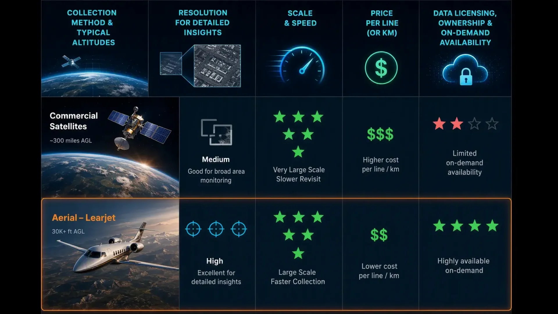
Satellite imagery and aerial imagery serve different purposes, especially for utilities managing vegetation near power lines. Sate…