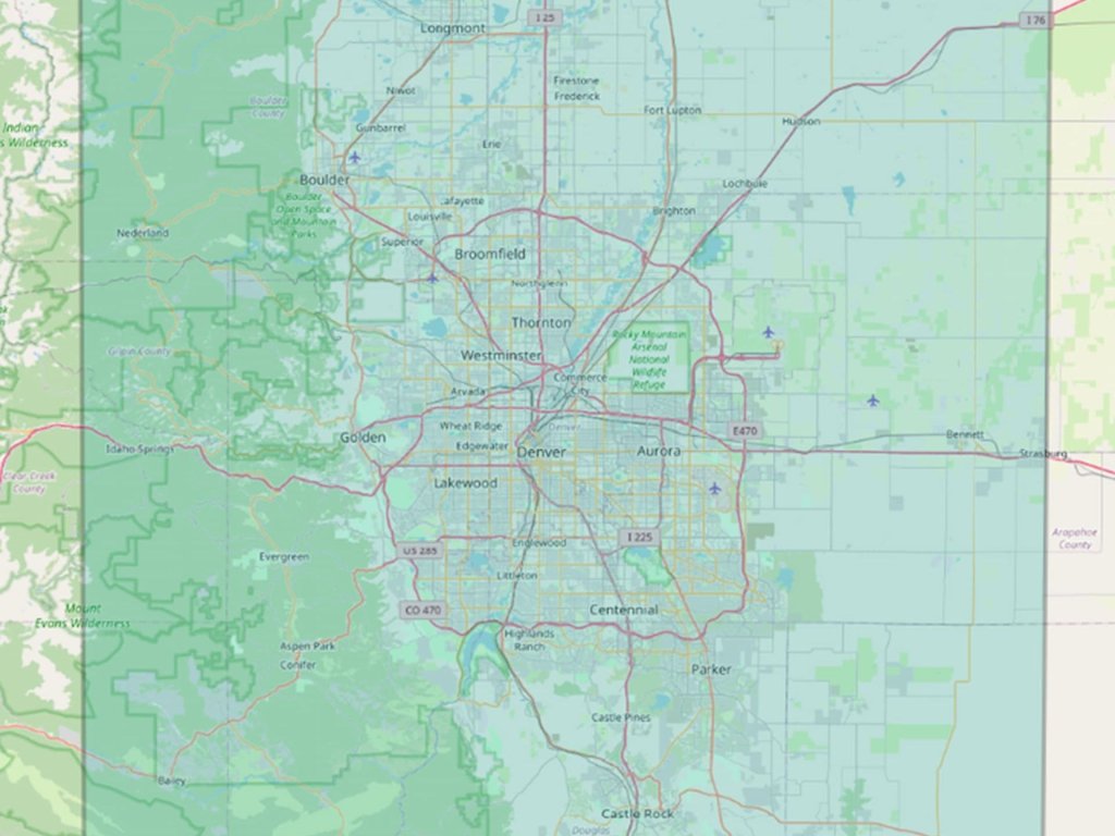
Seeing Scale Clearly: What 10,000 Square Kilometres Really Means
IO Aerospace™ offers large-scale, high-altitude aerial imaging capabilities, capturing up to 10,000 square kilometres of consisten…
Cost-effective wide area coverage provides 10 cm RGB imagery. The camera’s multi-look capability allows the rapid creation of orthorectified images, elevation models, analytics, and more.
Do you need to map large-scale areas – capturing extensive geographic data for detailed analysis – or are you looking to monitor specific conditions or changes in real time? Understanding the objective of your mission is critical as it allows our team to design a customized mission plan to achieve your goals.
We can fly your sensors, or we’ll source and fly other sensors suited to your mission, so you can focus on what matters most—collecting and analyzing the right data. With extensive experience in designing and flying remote-sensing special missions, our team works closely with clients through each step.
Our team offers customized payload testing services that focus on validating the performance of your various payload components, such as cameras, sensors, antennas, and scientific instruments. We work to ensure that each component performs at its best before launch, helping clients refine their systems and demonstrate the capabilities of their payloads early.
Leveraging decades of experience in remote sensing systems and payload testing, our team helps ensure that your satellite payload will perform as expected, delivering reliable data to support your mission.
Monitoring methane levels is essential for assessing its contribution to global warming and climate change. Detecting and quantifying emissions are the first steps toward targeted reduction efforts and ensuring regulatory compliance.
Using a specially modified aircraft, IO Aerospace™ provides advanced mapping services with fast, wide-area coverage. Our team crafts solutions to help clients identify, quantify, and reduce methane emissions, supporting regulatory compliance and environmental sustainability. With global coverage and real-time data, we enable clients to combat climate change.
IO Aerospace™ offers large-scale, high-altitude aerial imaging capabilities, capturing up to 10,000 square kilometres of consisten…
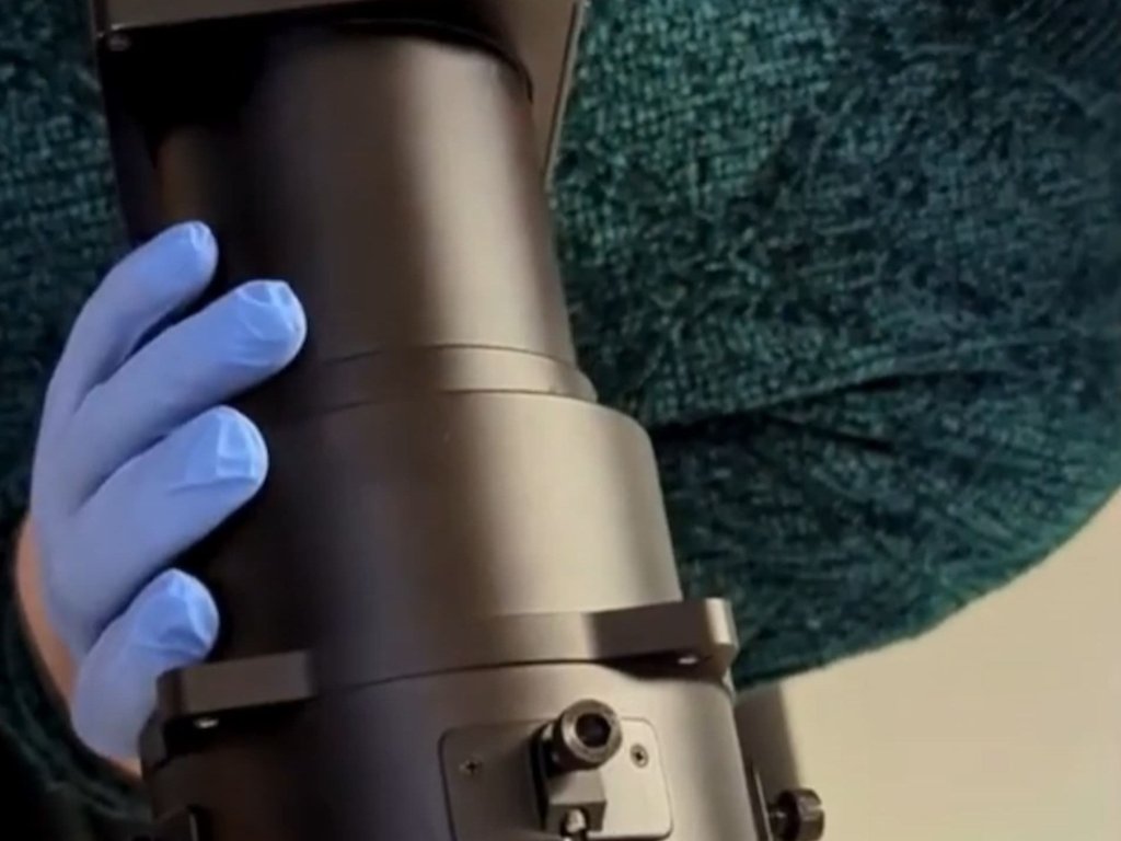
IO Aerospace, in collaboration with Phase One, has developed the RSM 300mm Shutterless Lens. This custom-built optical system is d…
Modern aerospace missions require sensing systems that deliver instant response, flawless performance, and effortless scaling acro…