Choosing the right aerial platform for your remote sensing mission is likely the second biggest choice you’ll make. Getting the choice of airborne platform correct means you can optimize the performance of your sensor, maximize your data collection, and manage your costs appropriately. Get the choice wrong, and you’ll be stuck with an aircraft that holds you back instead of propelling you forward.
This guide assumes you already have a sensor of some kind in development. If you want tips on developing a custom sensor we’re happy to help with that too. When choosing an airborne platform here are some things to consider:
Sensor size and performance
Since you’re starting with a sensor in mind, let’s start there.
What altitude gives the best results? Your sensor is likely designed for a specific altitude range so that you can achieve the proper balance of spatial resolution and coverage. Knowing this altitude band helps narrow down the field of available aircraft.
What speed can you go with the sensor? Go too fast and you’ll end up with blurry pixels, or gaps in your data. Go to slow and you’ll be spending more on fuel than necessary.
How smooth do you need the flight to be? Some sensors require a very smooth flight, others are able to handle some turbulence. The performance characteristics of your sensor will have an impact on the type of aircraft that can carry it.
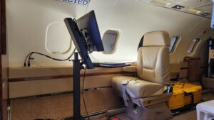
How physically big is the sensor? The sensor you have designed will need to fit inside the airborne platform of your choice. Aircraft don’t tend to have a lot of extra space inside, and we often ask our clients if they can you make their sensor smaller and fit in tighter spaces.
What mission parameters to consider when choosing the aircraft
You might have some idea of what kind of mission you’re planning, which will impact the choice of aircraft type. Are you looking to maximize wide-area coverage or do you have specific targets in mind for repeat visits?
How high, how fast, and how long? These are they key questions for mission design. When answered together they will provide a strong guide for which aircraft to choose. In most cases you’ll need to compromise on at least one of the parameters, or if you need all three, then you can expect to pay more for them.
How frequently are you flying? Does your mission require daily flights? Some clients want to maximize coverage and fly twice a day. If you have specific targets in mind perhaps monthly flights would do.
Mapping vs Monitoring? Are your missions designed to cover an area once and move on, or do you need high-repeat visits? Mapping and monitoring missions have different parameters and different outcomes. Depending on the nature of the event you’re monitoring for, they will likely have different aircraft needs as well.
Where are you operating? North America, Europe, Global?
Where are you flying? Depending on where you want to operate the avionics and systems requirements will be different. Operating in North America or Europe is easier than operating in the rest of the world and won’t require as complex an avionics package.
Where do you want to register the aircraft? In our experience an aircraft registered in the USA (N registered) or Canada (C- registered) is very easy to operate internationally, however for some applications or missions it may be easier if the aircraft is registered in the primary country it’ll be operating in.
Cost (acquisition and operations)
Finally, of course, how much do you have to spend? Likely you want to minimize the upfront costs and the operational costs. Sometimes it’s worth it to pay more for up front for an airborne platform that has a lower operational cost. Maintenance is another big cost center to watch, and depending on the aircraft age and type the costs could vary substantially.
Analysis and Modelling
Once you have the mission parameters, sensor details, and budget figured out you’ll need some framework to analyze the results and land on an aircraft selection. Our team of aviation and engineers are specialized in making this analysis and have the real-world remote sensing experience to back it up.
Final Thoughts
Selecting the right aircraft for your data acquisition mission is a critical decision, and one that is expensive to change after the fact! We advise all of our clients to think deeply about the types of missions that they are flying and the specific requirements of those missions before we embark on an aircraft acquisition and modification. Either way, the world of airborne remote sensing continues to grow, even in the era of space-based and drone-based mission systems.
Still have questions?
We’re happy to help and talk you through it.