Denver, Co: IO Aerospace is pleased to announce today the official launch of its high-altitude airborne mapping platform. The aircraft will be taking off on missions across North America as it aids in operationalizing remote sensing technology for data acquisition and testing pre-space sensor technology.
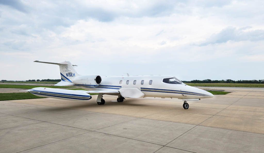
In late 2022, IO Aerospace acquired a Learjet 35 and began undergoing significant modifications to transform the aircraft into a high-altitude airborne mapping platform. The completed system boasts state-of-the-art technology for data acquisition and processing.
“What we have done is take a normal commercial jet aircraft and modified it into a fit for purpose high altitude, high-performance large-scale mapping system,” said cofounder and CTO Trevor Miller. “We’re turning a prototype sensor technology into an operational system and providing the expertise, customized hardware and software, processes, and personnel into a single highly efficient integrated system It’s really exciting and it’s really unique.”
Working with Avcon ISR Solutions out of Newton Kansas, IO Aerospace created a customized platform for this mission. Modifications include the addition of mid-fuselage dual camera ports and delta fins at the rear for increased stability. The tip tanks were also modified as they were extended to carry more fuel, increasing flight duration. With these enhancements the aircraft is capable of simulating near-space conditions and sustaining a flight at 40,000 ft (12,000m) and 400 kn (750 km/h) for between five and six hours.
“The Lear 35 is the perfect plane for the mission. They’re very versatile, they carry a good payload and can stay in the air a long time. They are just the ideal platform,” said cofounder and VP Aircraft Operations Marvin Keyser. “We’re on the leading edge of this. There is going to be more requirement for this type of work and we’re doing it for the right purpose.”
The modification of the aircraft and mounting of the prototype sensor were completed in just under nine months, a very quick timeline for such a unique and custom project. Now operational, this platform will enable high-volume data collection of over 10,000 km2 per day. The first tasking for this platform is a long-term science focused mission with targets across the continental United States and abroad.
“With the launch of this jet we are excited to lead the industry by providing unique services to our clients not available otherwise,” said IO Aerospace President and CEO Jonathan Neufeld. “With our experience and expertise, we look forward to delivering custom remote sensing services for clients and further pushing the boundaries of what was once thought impossible.”
About IO Aerospace: Located in Denver, Co., IO Aerospace was founded in 2022 with a vision to transform sensor technology into unique operational capability. With a team of innovative and forward thinkers, the mix of expertise and services provided at IO is next to none. Combined, our team has mapped millions of square kilometres in over 20 countries has providing them with the experience and knowledge to know what it takes to get reliable data sets. IO Aerospace is a specialized firm that helps clients by providing end-to-end services for specialized aviation remote sensing missions including sensor design, integration, aircraft acquisition, flight operations, centre management, data quality control, and more. Their mission is to equip companies with the ability to scale their missions to new heights.