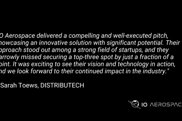
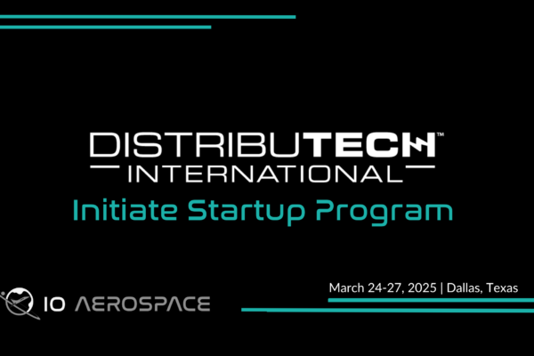
DistribuTech 2025 was an incredible opportunity for IO Aerospace to showcase our capabilities, connect with industry leaders, and gain valuable insights into the evolving utility sector. From our conversations with attendees to our success in the Initiate Startup Pitch Competition, the event reinforced the need for high-resolution, rapid-turnaround geospatial data […]
Read MoreArticles
IO Aerospace Heads to DISTRIBUTECH’s Initiate Program
Big news—we’ve been selected for the Initiate Program at DISTRIBUTECH International 2025! This means we’re heading to Dallas, Texas, from March 24-27 to showcase what we do best: high-altitude remote sensing. Initiate is all about connecting up-and-coming companies with industry leaders, giving us the opportunity to exhibit and present amongst […]
Read MoreWhy We Created IO Imagery
Discover 10 cm high-resolution imagery, fast delivery, and tailored solutions for diverse industries like agriculture, utilities, and emergency response with IO Imagery.
Read MoreComparing CO2 Emissions of Traditional Data Acquisition Aircraft with the IO Learjet
Airborne remote sensing missions contribute to CO2 emissions, but choosing the right aircraft can significantly lower your mission’s carbon footprint. While traditional propeller planes are commonly used, jets like the IO Aerospace Learjet 35A offer superior benefits and optimizations that help reduce CO2 output, making them a more sustainable option for large-scale data acquisition projects.
Read MoreThe Truth About Image Resolution: Transparency for Informed Decision-Making
Marketing of satellite imagery often highlights global coverage and high resolution, but the limitations are buried in the fine print. Aircraft, however, offer higher precision, faster turnaround, and greater flexibility, making them ideal for industries needing timely, accurate data. Discover the truth behind satellite vs. aerial optical imagery.
Read More5 Reasons Why Airborne Data Acquisition is Here to Stay
Five years ago, if you had asked us about the future of airborne remote sensing, we would have told you that drones and satellites were poised to dominate the market from both ends. Satellites, capable of flying high and staying up permanently, can capture vast amounts of data. Drone technology, […]
Read MoreMastering Tactical Flight Planning for Remote Sensing Missions
This article delves into the intricacies of tactical flight planning, highlighting its significance in ensuring data quality and how it streamlines operations for organizations like IO Aerospace.
Read MoreSpace-Bound Hardware Testing
Aerospace companies continually develop cutting-edge technologies for space missions. From propulsion systems to life support equipment, the hardware must undergo rigorous testing to ensure reliability, durability, and performance. Space presents a harsh environment characterized by extreme temperatures, vacuum conditions, radiation exposure, and microgravity. Hardware destined for space missions must withstand […]
Read MoreMapping or Monitoring: Which Mission Fits Your Needs?
Discover the key differences between mapping and monitoring missions in geospatial data collection. Learn how to optimize mission design with insights from IO Aerospace.
Read MoreIO Aerospace: Pioneering Solutions for a Unique Sky Journey
At IO Aerospace, we embrace curiosity and innovation, echoing through every mission we undertake. As a specialized aviation and remote sensing company, we don’t just provide solutions; we redefine what’s possible. Let’s delve into who we are, what we stand for, and how we’re transforming prototypes into operational reality, prioritizing […]
Read More