As the world becomes more interconnected and reliant on data, there is a growing need to make sense of all the information and knowledge that data offers us. With this, the demand for remote sensing capabilities is growing rapidly.
To achieve a project’s goals and allow for mission scaling, those involved in remote sensing missions need to approach and analyze the project from all angles. At IO we have built a team capable of doing just that.
In addition to our expertise in aviation our team also has developed knowledge in geospatial and the evolving technology that supports the industry. With this expertise, the IO team can address a wide range of needs and mission objectives. We provide clients with unique capabilities that go beyond aviation. With a special missions’ focus, IO Aerospace is different than other aviation or general mapping companies. Our unique capabilities and expertise in geospatial set us apart, allowing us to support our clients through each step of their project.
More than just a traditional flying company
We recognize that mapping missions require expertise that goes beyond traditional flying and that special missions are more complex than just point A to point B. There are many differences between mapping and monitoring projects as well as challenges that make each mission unique, no matter the focus. IO Aerospace has a team of skilled pilots and trained sensor operators. We support complex and challenging remote sensing missions and maximize flight time to deliver as much data as possible through a production-oriented approach.
We are dedicated to serving our clients missions and have a deep understanding of the technical requirements involved in mapping and monitoring. Providing tactical planning, including weather assessment and priority area management, our team is able to effectively take on the project management of any mission. Additionally, we know the importance of flexibility in operations, which is why our pilots are adaptable and can support changing priorities in the air.
Supporting clients at all stages of readiness means that our team can aid in designing any mission from the ground up while understanding the impacts mission choices can have on its subsequent data. With this knowledge, we understand the importance of assessing standard factors. These factors include how flying altitude may affect the data and how the angle and positioning of the sun and clouds can impact the imagery.
Operational Flexibility and Expertise
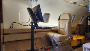
Working with various sensor types from LiDAR to spectrometer – our team can confidently assess and troubleshoot hardware and software as needed. Possessing the experience and expertise means that our operators are also able to adapt to changing priorities that a mission may experience whether on the ground or in the air. Once when working on a mission in Asia, one of our operators encountered an issue with the aircrafts radar. The operator was able to fix the radar issue and get the mission back up and operating. Without this on-the-spot troubleshooting the mission would have been down for six or more months just waiting for new parts.
Having a diversely skilled team with the developed expertise and years of experience allows us to provide clients with full operational capabilities for their airborne special missions. From mission designing and planning to flying and operations, our team is here to help push the limits. We also handle managing, uploading, processing, and shipping collected data as required, all in pursuit of discovering new horizons.
Whether it’s the mission goals, sensor type, amount of data acquired or another element, no two missions are exactly the same. By approaching each mission we work on with a fresh slate and open mindset, applying our expertise and experience allows us to effectively and efficiently help clients take off.
Advancing Geospatial and Remote Sensing Capabilities
The need for this geospatial technology and capabilities extends across industries. Its applications are growing to include government and defense, agriculture and mining, climate disaster tracking, and global mapping. By testing the boundaries and pushing the limits on data processing, data science and delivery, we can help to mold the future of data acquisition and processing.
The future is not given but built – and with IO Aerospace’s unique position, providing both expertise and experience in aviation as well as geospatial and geospatial technology we do just that. By applying our understanding and experience to each project we approach, our team is able to scale missions and push the field forward, providing our clients with unique capabilities and innovative solutions enabling them to thoughtfully build and transform the future by understanding the data of today.